China unveils first global panoramic images of Mars
国家航天局和中国科学院联合发布了中国首次火星探测火星全球影像图
China published on Monday the first global panoramic images of Mars taken by the country’s Tianwen 1 orbiter. They were jointly released by the China National Space Administration and the Chinese Academy of Sciences at a ceremony in Hefei, capital of Anhui province, marking this year’s Space Day in China.
日前,在2023年“中国航天日”主场活动启动仪式上,国家航天局和中国科学院联合发布了中国首次火星探测火星全球影像图。
The color images include the Robinson projection, Mercator projection, azimuth projection and orthographic projection of the Eastern and Western hemispheres of the Red Planet, with a spatial resolution of 76 meters.
本次发布的影像图为彩色,包括按照制图标准分别制作的火星东西半球正射投影图、鲁宾逊投影图和墨卡托投影加方位投影图,空间分辨率为76米。
The panoramas were made through the processing of 14,757 images taken by the mid-definition camera mounted on Tianwen 1’s Martian orbiter during its 284 remote-sensing maneuvers from November 2021 to July 2022.
天问一号任务环绕器中分辨率相机,于2021年11月至2022年7月历时8个月,实施了284轨次遥感成像,对火星表面实现了全球覆盖。地面应用系统对获取的14757幅影像数据进行处理后得到火星全球彩色影像图。
They are expected to provide better base maps for scientists and engineers around the world to facilitate their research and planning for future expeditions to Mars, the administration said.
国家航天局表示,这将为开展火星探测工程和火星科学研究提供质量更好的基础底图,也将为人类深入认知火星作出贡献。
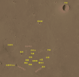
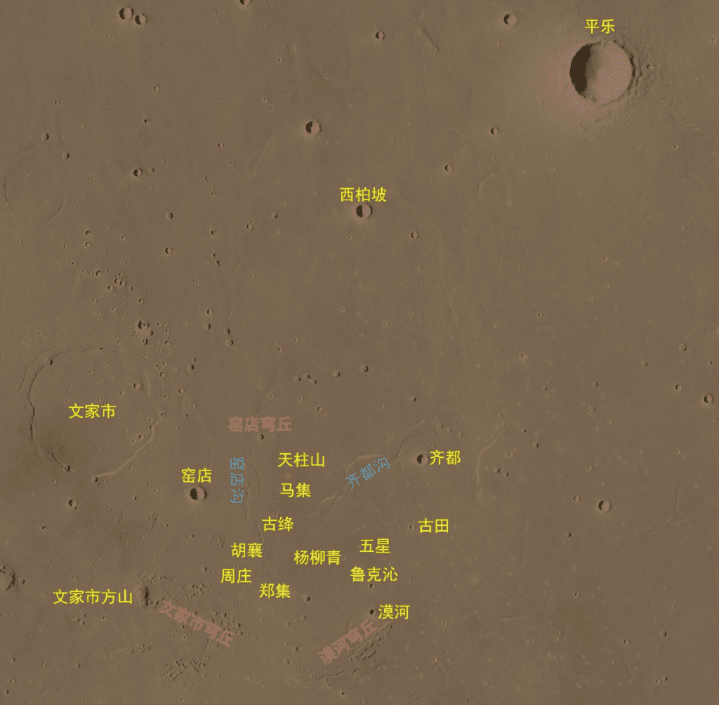
Through the study of images and data from Tianwen 1, Chinese scientists have spotted and identified many geological bodies surrounding the landing site of Tianwen 1 and have named 22 of them after Chinese villages with renowned historical and cultural heritages.
科学研究团队通过火星高分影像,识别了着陆点附近大量的地理实体。国际天文联合会根据相关规则,将其中的22个地理实体,以中国的历史文化名村名镇加以命名。